Calochortus nuttallii , Fort Boise Military Reserve, Idaho, July 5, 2022

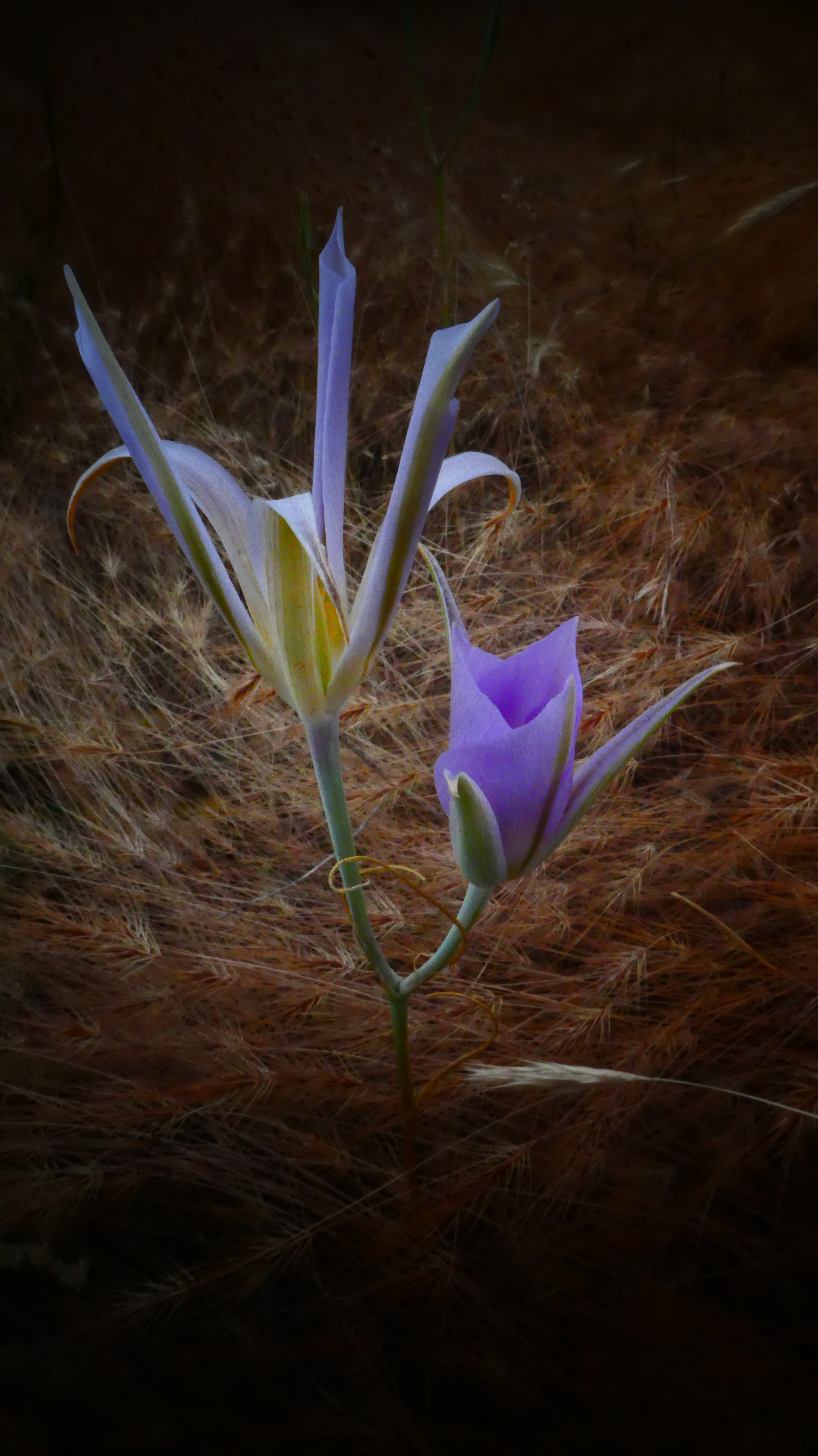
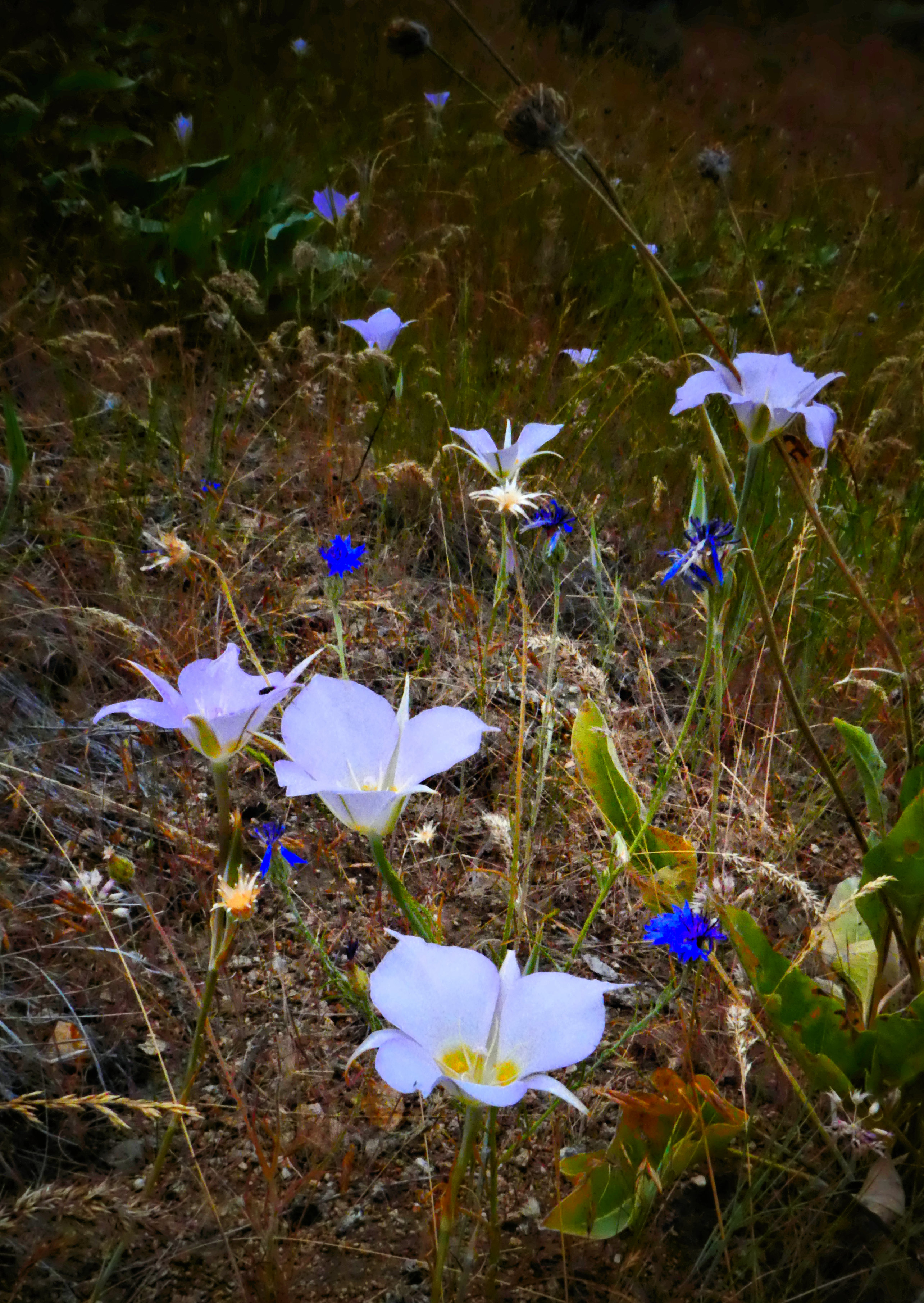
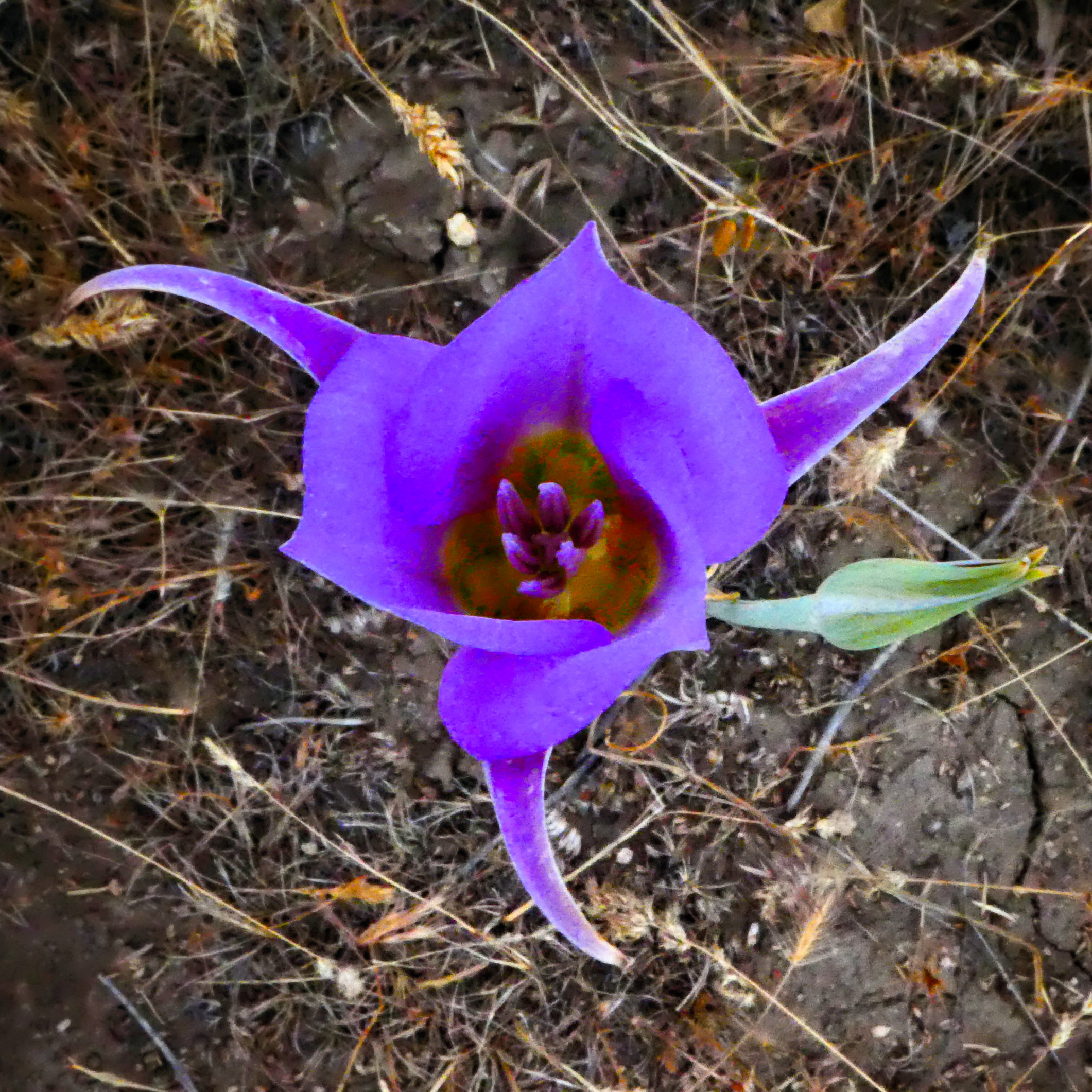


Calochortus nuttallii , Fort Boise Military Reserve, Idaho, July 5, 2022
It’s time to envision, identify, and preserve an “emerald necklace” of trails and open lands encircling Boise from its southeast, south, southwest, west, to its northwest.
Boise airport officials are asking the city to rezone for industrial development what may be the last sagebrush forest on the city’s edge. The 77 acres is zoned A-2, Open-Land Reserve District “to provide for permanent open space and to properly guide growth of the fringe areas of the city.”
In early January, I decided to go take a look after reading the compelling testimony of Indian Lakes and Western Riding Club neighbors opposed to the plan to build industrial facilities behind their homes. As I approached the area, the first thing I noticed was a hawk circling above. She certainly did not view the land as “vacant and unused,” as it is described in the airport’s rezoning application.
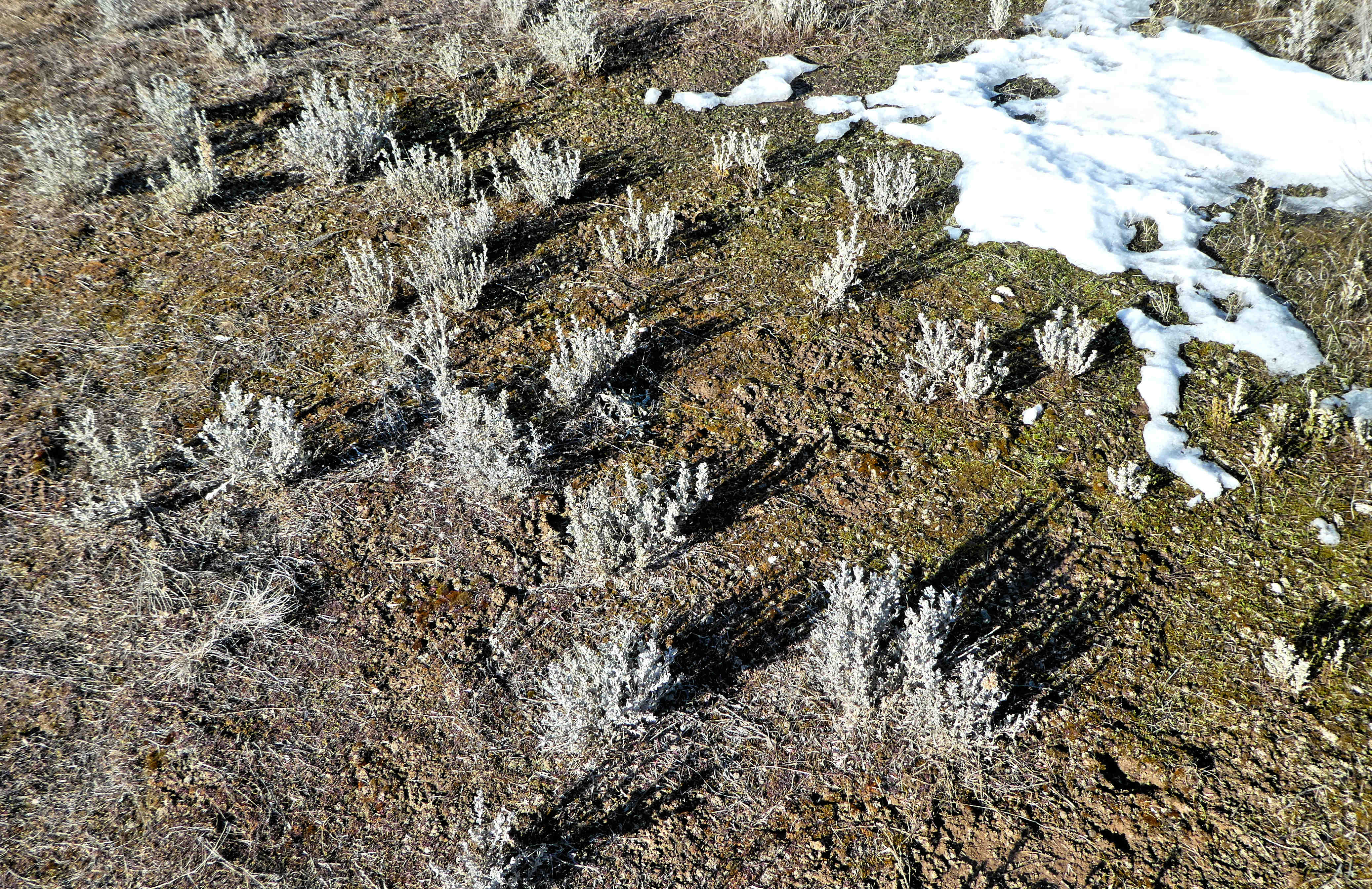
Then I went through the Indian Lakes neighborhood to the southwest corner of the A-2 properties. From both vantages, what I found is a dense sagebrush forest extending a half-mile to the east and to the south.
The sagebrush habitat—seen here, looking north—is much more extensive than anything we have in the Fort Boise Military Reserve, Boise’s first and largest open-space reserve, next to which I’ve lived since 1986.
The Military Reserve was once viewed by some as “vacant and unused.” In the early 1970s, Aldape Heights neighbors noticed speculators scoping out the Military Reserve for development. The original 460 acres had been patented to the city by the federal government in the 1950s. Led by parks commissioner Alice Dieter, photographer Stan Burns, and the US Interior Department’s Idaho solicitor Bill Dunlop, the Aldape neighbors negotiated a reversion clause into the patent, which permanently protects the now 734-acre Military Reserve from development.
In this case, there is no federal patent to fall back on. It’s up to city officials, guided by public input, to recognize and acknowledge the unique ecological and recreational values of this place and continue to protect it as open land.
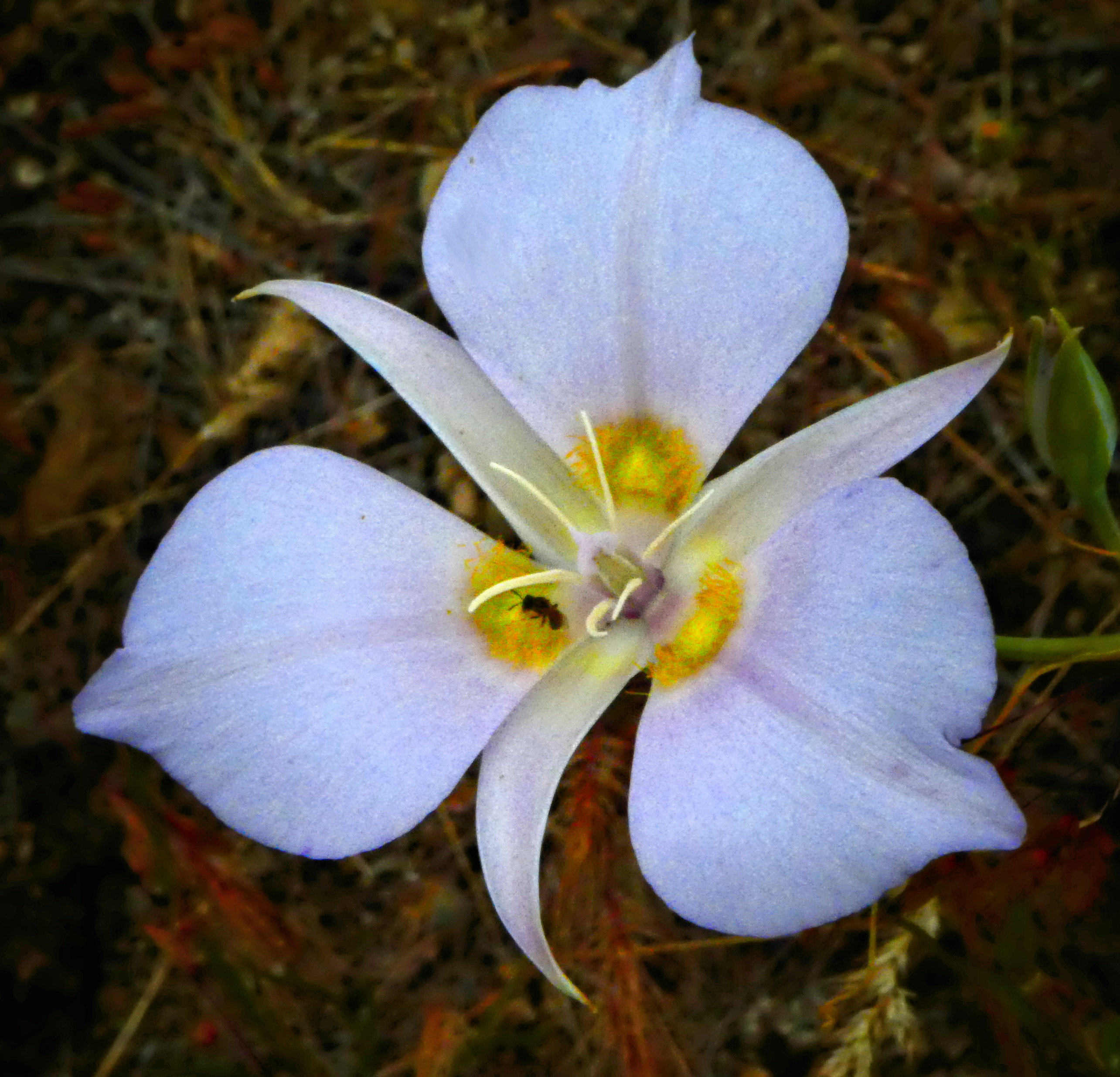
On Feb. 6, accompanied by a botanist familiar with the sagebrush-steppe ecosystem, I decided to take another, closer look at the area the airport is asking to rezone for industrial development. This is likely the largest sagebrush steppe remnant in Boise. Wherever there are clearings in the sagebrush, we found cryptogamic soils—a thin, fragile crust made up of mosses, lichens, algae, and bacteria—which are found in undisturbed areas throughout the Columbia and Snake River Basins.
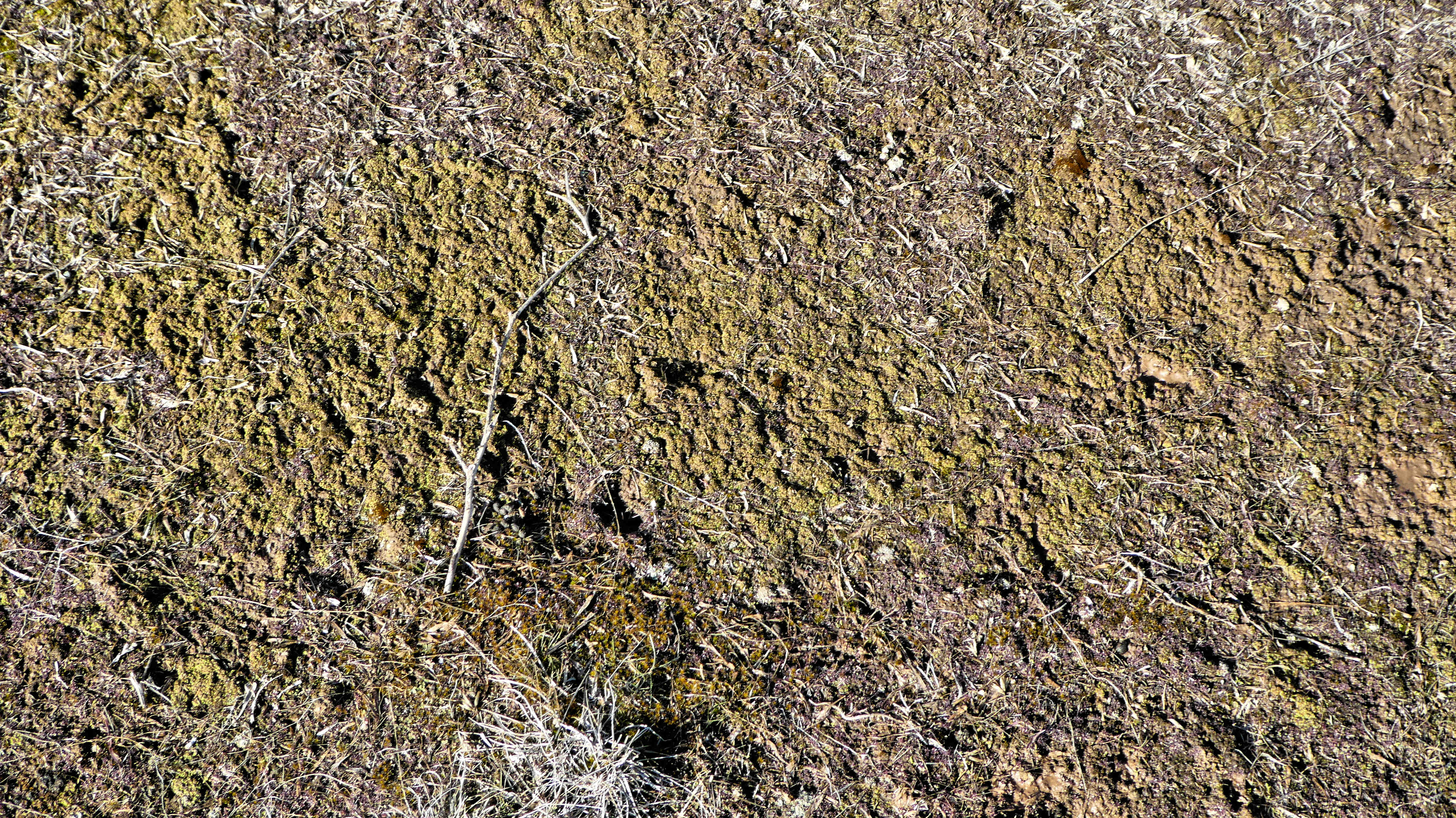

Cryptobiotic crust has been dubbed the “protector of the desert” because the sticky webs of soil retain water, so plants are able to root into the spongy crust, which enables them to survive hot, dry conditions. It then converts nitrogen from the air into usable nitrogen to help plants grow—the perfect breeding ground for young sagebrush starts:


In 1990, the airport purchased this land, ostensibly to protect it from residential development within the airport influence zone. The land was then outside the city limits in Ada County and was zoned RP, Rural Preservation. In 2005, the land was annexed into Boise City and zoned A-2, Open Land Reserve, a zone comparable to its Rural Preservation designation by the county.
Airport officials now want to rezone the land so that it may be leased for light-industrial development in order to finance the expansion of airport facilities. In the rezoning application, the parcels are described as “vacant and unused.” There is no evidence that the ecological and recreational values of the property were surveyed or considered. There is only the simple assertion that “Light industrial would be the best use of these properties as they are within the Airport Influence Area…”
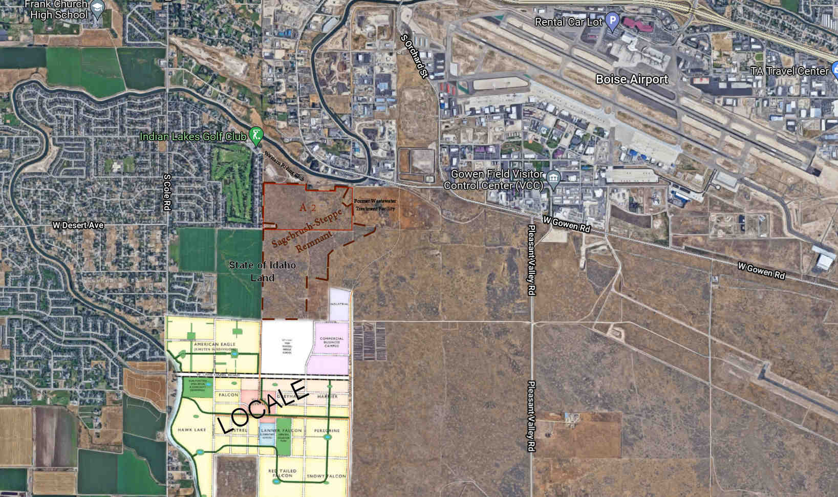
More than 2,000 new homes have been approved in the Cory Barton Homes “Locale” development that is being constructed on the southern edge of the sagebrush-steppe remnant about a half-mile from the A-2 parcels. There are plans for more residential, commercial, and industrial development in the surrounding area.

In addition to the 77 acres included in the airport’s A-2 open-land reserve, there are about 100 additional acres of sagebrush forest on State of Idaho lands that also should be preserved.

Alexander Garvin was a renowned New York City architect and city planner who passed away in December. Alex produced the 2004 BeltLine Emerald Necklace plan that added 1400 acres of parkland and miles of trails as Atlanta developed its BeltLine corridor.

The Cleveland, Ohio, metropolitan area where I grew up is also encircled by an Emerald Necklace of parks, trails, and open lands envisioned over a century ago. These urban and suburban amenities have proven invaluable.
The Boise area’s Ridge-to-Rivers system of trails and open space is unparalleled, but it is largely in the foothills to the city’s north and east. It is high time for Boise and surrounding communities to envision, identify, and preserve an “emerald necklace” of trails and open lands encircling the area from its southeast, south, southwest, west, and northwest.
The Sagebrush-Steppe remnant southwest of the airport just east of Indian Lakes would be a worthy gem to hang on such a necklace. Air travel is the least efficient form of transportation on our planet. In light of the city’s goal to reach “net zero” fossil-fueled energy by 2050 or earlier, it’s time to start asking ourselves difficult questions: How many more jet-fueled passenger miles would destruction of this sagebrush forest buy Boise? Seems like a devilish deal to me.
The Boise Planning and Zoning Commission has scheduled a public hearing on the airport’s rezoning proposal, CAR21-00037, beginning at 6 p.m., Monday, March 14, 2022, at City Hall. Members of the general public have 3 minutes, or approximately 500 written words, to testify. Written testimony and documents—no word limit— may be submitted by 5 p.m. on Thursday, March 10, 2022. Email: crain@cityofboise.org
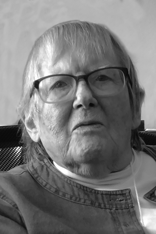
There was an aftershock felt in Boise early last week, somewhere in the 4–5 range on the Richter Scale. Alice Dieter passed away at home on Sunday, April 19, 2020. Alice was a Force of Nature.
For 15 years (1964–1979), Alice served on the Boise city parks board when parks superintendent Gordon Bowen was shaping a caretaker agency into a park system. Among her many accomplishments, Alice worked tirelessly for more than a decade to help make the Boise Greenbelt a reality.
Alice also was instrumental in saving the Fort Boise Military Reserve from development. When she and her husband, Les, moved to Boise in 1955, they built their first home in Aldape Heights. About the same time the city acquired the Military Reserve from the feds. In the early ’70s, she and neighbors, including Bill Dunlop, then US Interior solicitor for Idaho, became concerned. They got wind that developers were sizing up the reserve for residential development.
With Alice on the Parks board, they worked to have the federal land patent reissued with a master plan and firm non-development directives. The idea was that any activities, including recreational uses, would be allowed strictly in ways that do not compromise the natural state of the area.
At the time, the Fort Boise Military Reserve was the only reserve in the park system. At a staff suggestion, Alice worked to establish a clear distinction between parks and open-space reserves. She led the commission in adopting the following definition: Properties that we will retain in their ecologically natural state will be called “reserves.”
When I visited with her a couple of years ago, she said one of her greatest regrets was that she did not press to establish separate parks and recreation boards. She foresaw the danger that the parks and recreation commission would be dominated by recreational interests and lose sight of the passive values of parks and open space.
In 1986, I moved to Aldape Heights adjacent to the Military Reserve. A few days after we got settled in, Alice came calling, I assumed to welcome us to the neighborhood. I invited her in. Alice could be direct; she got right down to business.
“Gary, you and I are going to start the Friends of Military Reserve.” She paused just long enough for me to understand that this was a direction, not a suggestion. “When the North End and the East End begin limiting access to foothills development, access through Military Reserve is not going to be an option,” she explained. Thus, Friends of Military Reserve were organized in the summer of 1986 with Alice Dieter as chair.
Alice was right about Mountain Cove Rd: There were repeated attempts over the years to “upgrade” Mountain Cove Rd. in violation of the reserve master plan, which specified that “Parking lots and upgraded roads including the three main roads will have a gravel surface.” In 1988, likely responding to pressure from a few large property owners, the city quietly got the BLM to sign off on a plan amendment allowing “the granting a right-of-way to the Ada County Highway District for the Mountain Cove Road and authorizes paving of the road.” Both the Simplot and Hawkins families had foothills properties above the reserve. The Hawkins land is now part of the reserve thanks to the first Foothills Open-Space Levy, which Alice supported.
At one point, ACHD actually began preparing Mountain Cove Road for paving. Friends of Military Reserve requested a public hearing, which was held Oct. 30, 1990, when paving the road was overwhelmingly opposed. Yet, a year later, the Ada Planning Association proposed a Mountain Cove Parkway through the reserve. Each time the proposal to pave the road comes up, it has successfully been thwarted. My guess is that, like the proposal for a cross-foothills thoroughfare, it will continue to crop up from time to time unless a clear prohibition laid out in the Reserves Master Plan puts that genie back in the bottle. Alice would like that.

You must be logged in to post a comment.